Monday, October 5, 2009

Tri-Cities Cross Race & Virginia Creeper

After a break from my daily blogging, I figured I'd document the most recent weekend adventure. Saturday morning, Molly and I left Knoxville for a cross race up in Kingsport, TN. This was the first race in the MSG series and saw a huge turnout in every event, including Jeremy, Derek, and Kevin "The Freak". On Sunday, I opted out of the second day of races so Molly and I headed to Abingdon, VA for ride on the Virginia Creeper trail. We rode all the way up through Damascus, VA to White Top Gap and then returned back to Abingdon totalling a 68 mile ride.


At the top of White Top Gap - Halfway done


Derek hitting the fly-over in the singlespeed race


Jeremy and Me on the fly-over


Jeremy attacking the barriers


"The Freak"


Jeremy


Me suffering

Wednesday, July 8, 2009

Looking back...

So the total trip ended up being 4456 miles by my cycling computer, and in 56 days, gives an average of right at 80 miles a day. I don't know the total climbing exactly, but another blog of the same route said they measured it somewhere around 120,000 feet of climbing over the trip. We amazingly, only had one day where it rained all day. Other than that day, we only had a few isolated storms that lasted about an hour or less. We really lucked out weather wise.

Superlatives:
- Out of everyone that we saw, we had the lightest load/least amount of gear. I think this was a huge contributor to the fun factor of the riding.
- Out of everyone that we saw, we had the fastest daily average. We may not have ridden as many miles each day as some, but we rode faster.
- Our fastest day: Breckenridge to Pueblo, CO. 140 miles at 20.5 mph average.
- Our longest day: White Hall to Yorktown, VA. 207 miles at 18.4 mph average.
- Our slowest day: Lexington to White Hall, VA. 66 miles at about 13.5 mph average.

Things I would have done differently:
- Mountain bike shoes with spd pedals instead of the road shoes and pedals I had.
- 28 width continental gatorskin tires instead of the 25's. I can't complain about the tires themselves though. With one rotation, they made it across with no problem, but the a little bit wider tire might have been nice in a few situations.
- Running triple front chainrings instead of the compact double I had. The gearing range was completely adequate, but it would have been nice to have a few more gears to choose from in the middle. Also, in some cases, I was jumping back and forth between the big and small chainring where a middle chainring on a triple would have been adequate.
- Next time I will run a 36 spoke rear wheel. I wish I had shown a little more concern for my rear wheel before starting...and maybe avoided some of the headache in West Yellowstone.

Valuable Tidbits:
- The multifuel stove capable of running auto gasoline was awesome. We never had to worry about finding fuel and it only cost about $0.35 to fill up.
- The 35 degree down bag was perfectly adequate and packed super small.
- Taking only the tent poles and rainfly saved a ton of weight and room and never let us down in the torrential downpours we had. The bugs weren't an issue either if you pitch it after its completely dark.

I'm sure there are things that I am forgetting, so post up a comment if you have a question about anything. The trip was really awesome and I can't say anything bad about it at all. I would recommend it to anyone.

Friday, July 3, 2009

Yorktown

Day 56: 207 miles - We went to bed last night hoping we would be able to finish today. We got up at 5:30 and were on the bike by 6:30. The route for the first 100 miles was beautiful rolling hills through central Virginia near Charlottesville. We rode right by Montecello as well as a few other historic estates and landmarks. We finished our first 100 miles in 5:27 right around noon and stopped for lunch at 112 miles in near Ashland, VA. After we had downed some food, we knew we could finish out the trip today. We had 95 miles to go after lunch and although the legs felt great, the saddle was getting very uncomfortable. We made great time for the next 80 miles and arrived in Williamsburg just before 7pm. The trip down highway 5 was also beautiful with a bunch of different old plantations scattered in the last 25 miles before Williamsburg. Once in Williamsburg, we had 13 miles down the Colonial Parkway to our final destination. So after about 45 minutes of terribly painful cobblestone/rough road, we rolled up to the Victory Monument in downtown Yorktown around 7:45 and found a blaring firetruck in the greating party.


Andy and I were both dazed after spending all day on the bike, but rolled down to the water front and took our symbolic dip in the bay to seal the deal. The second century of the day ended up taking 5:24 and we averaged 18.4 mph for the entire 207 miles. Time for some food, a bath and a bed. Trip summary to come soon.

Wednesday, July 1, 2009

Blue Ridge Parkway

Day 55: 66 miles - A few days ago, we realized that there wasn't going to be anywhere in Lexington to camp, so I called the city police yesterday to ask if we could camp in one of the city parks. I got transferred to a supervisor, and he gave us the ok. He said that he would leave a note for the dispatcher and to call if we had any problems. Last night at about 11pm, a police car comes hauling across the gravel parking lot with spotlight and all. An officer got out and asked, "what are you doing?". It seemed pretty obvious to me, but I told him that we were traveling across country by bike and had permission to camp here. He didn't believe me for a minute and told me that the park closes at 11pm and camping is not allowed. He asked who had given permission, but of course I couldn't remember and didn't write it down. Finally, I told him that the dispatcher should have a note saying it was ok. He radioed, just in an effort to prove me wrong, wearing a pretty big smirk on his face until the dispatcher repeated everything I had told him pretty much word for word. After that, he told us to have a good evening and promptly drove away.

This morning we got up and moving with a lot of anticipation for this climb we had been hearing about. Ever since about Kansas, people riding west have been telling us how hard this climb up to the parkway is going to be for us eastbounders. I rarely heard anyone talk about it without a swearing. We hit the base of the 4 mile climb at about 19 miles in. The middle 2 miles was pretty steep, but I was expecting it to get a whole lot tougher near the top. As we got closer to the top, I could hear cars on the parkway and the grade was gradually lessening. Before we knew it, we were up on the parkway, wondering where this climb was that everyone had been talking about. It was definitely one of our harder climbs, but it really wasn't the heinous suffer-fest that everyone had made it out to be. After that, we cruised along the parkway for almost 30 miles and then dropped off the eastern side.

So with that, our time riding through the Appalachians is done and we are 205 miles from Yorktown. We're shooting for a grand finale finish tomorrow, but we'll just have to see how it goes.

Tuesday, June 30, 2009

Lexington

Day 54: 85 miles - We got a late start out of Blacksburg this morning, but had a pretty relaxed ride to Lexington. We had a few fairly intense rollers, but nothing major and the decent tailwind helped us average right at 18 mph. Tomorrow we climb up to the Blue Ridge Parkway which I'm expecting, will be the hardest climb of the whole trip. Everything we've heard about it is, its the steepest thing anyone has ever seen...and its 4 miles long. We'll see how it goes. After that though, its 200 miles of flat to Yorktown.

Blacksburg

Day 53: 68 miles - Another pretty easy day with a few rollers, but no significant climbs. Nice riding and nice weather. We stopped off in Blacksburg for the night to see Patrick, a friend of mine from BMW. He showed us a good time in Blacksburg and around VA Tech and let us crash in his apartment. 450 miles to Yorktown.

Virginia Creeper

Day 52: 61 miles - So at some point last night, my parents decided that they were going to skip the family reunion and drive from Charleston, SC to Damascus to ride the creeper with us. I guess they finally arrived sometime around midnight. We got to hang out for the morning while eating the continental breakfast at the hotel before hitting the trail. Dad, Adam and Poppop rode the 11 mile section up the Virginia Creeper Trail with us before we got back on the asphalt. Mom and Mammy met us at the top to send us on our way for the last 400 miles. It was really great for them to get to come be a part of our ride.


The whole bunch

After the 11 miles

Back on the road

After we left the family, we finished out the pretty relaxed day in Wytheville, VA. No more big climbs until we climb up to the Blueridge Parkway on Wednesday.


Sunday, June 28, 2009

Damascus

Day 51: 83 miles -When we started out this morning, it was really foggy and humid as we immediately started climbing. It wasn't a particularly tough climb up to Breaks Interstate Park, but I could not get my legs going. I guess it was the culmination of the last few intense days, but my legs just seemed unreasonably tired and my knees hurt. We stopped for lunch halfway through our mileage and after a little break, I felt a lot better on the bike for the rest of the afternoon.

Coming off the last mountain of the day, we had an incredible descent. It was probably the best road I have ever ridden. It was about a 1200' drop over 4 miles, tight and twisty 25 mph curves the whole way down. Andy and I joked about climbing back up just to ride it again. If you're ever in the area, ride SR 80 into Hayters Gap.

From there we hauled into Damascus, VA where we met my grandparents. They treated us to a hotel room and a really awesome meal at an "Italian" restaraunt.

Tomorrow we start out with an 11 mile section on the Virginia Creeper Trail.

Saturday, June 27, 2009

Virginia

Day 50: 85 miles - After 50 days of riding and almost 3900 miles, we're at the Virginia state line. The riding today was pretty similar to yesterday. We had a few nice gradual stretches along some rivers between the mountains. We also had four pretty significant climbs today. The third one was the steepest and longest we've had in a while and had me wishing for a few more gears. The descents today were as good or better than the ones yesterday. I think I'm going to have to rig up my camera somehow to get a video of one of these thrill-rides.

Also today, we met a guy heading west from Ohio bound for Astoria. He didn't really have much of a plan beyond that other than mentioning maybe riding home via the northern tier route. Pretty crazy.

We ended the day in Elkhorn City about a mile from the Virginia state line. Tomorrow we'll be heading to Damascus, VA and will meet my grandparents there for the evening. I think they are going to ride the 11 mile section along the VA Creeper trail, so I'm really looking forward to that.

Thursday, June 25, 2009

Coal Country

Day 49: 100 miles - After getting out of Berea this morning, we immediately began riding up this beautiful valley into the heart of western Appalachian range. Over the course of the day, we had several significant climbs and were shortly followed by the best descents we've had the whole trip. They were screaming fast with tight banked turns. It felt like each one was better than the last and led to one of the best days of riding of the trip so far.

We stopped in Booneville for lunch and ran into a guy from Madrid named Raul who was heading west on the transam. We had a great time talking to him and answering all of the questions he had about the rest of the trip.

As we got closer to Hazard, KY, we saw some weather moving in. Luckily we found some shelter in a BP just as it unloaded. We had high hopes of going another 23 to Hindman, but I guess it's going to have to wait until tomorrow.

We'll be camping in Damascus, VA Saturday night and riding an 11 mile section of the creeper if anyone is interested in joining us.

650 miles to Yorktown

Berea

Day 48: 75 miles - Knowing today was going to be a little shorter, we took a little time and slept in. We eventually got rolling and covered the first few morning miles easily. The terrain here was as it has been...rolling hills through farm land. As we got into the afternoon, the hills got a little steeper and we were able to see some of the Cumberland plateau off in the distance. I can't wait to get back in the appalachians and ride on my favorite terrain.

We ended the day in Berea, KY, a pretty cool college town with a lot of history.

Also today, we crossed US 127, the highway that runs south right past my house in Chattanooga. We're getting close now.

Tuesday, June 23, 2009

Bardstown

Day 47: 91 miles - This morning, we had a long haul before stopping in Bardstown, KY for our ritual lunch siesta. We got rolling early and felt pretty good, so we figured we'd knock out as big of a chunk as possible before it got hot. So at 71 miles, its been our biggest morning yet. We've got 20 more miles to go before our stopping point for the night in Lincoln Homestead State Park. Riding this morning was a little cooler than its been for the past week. I don't know if its the temperature or the humidity, but I was actually pretty comfortable for most of the morning. Lets hope this cooling trend continues.

After today, 820 miles to Yorktown.

Eastern Time Zone

Day 46: 98 miles - After a relaxing day in Sebree, we got back on it today. We got an early start, about 6:45 I think and knocked out about 55 miles before stopping for some lunch. The riding recently has just been pretty comfortable rolling hills through trees and fields. The variety has been very enjoyable and the miles have passed pretty quickly. After lunch, we rode across the Rough River Dam and along the Rough River Reservoir, an Army Corps of Engineers lake. The scenery changed a bit here with some bigger ridges with rocky shorelines. We were really hoping to take a swim in the lake at some point during the afternoon, but the only area where we could have was a Army Corps campground. They wanted to charge us for a campsite to go for a swim. Needless to say, we passed on that.

While we were eating lunch, I called the place where we were planning on sleeping for the night to check on rates. It was listed as a hostel and campground, so I was curious what they were going to charge for each. I called and asked...the response I got was "Free, is that cheap enough for you?". I was pleased with the response, but knew it was going to be an interesting evening.

After a bit more riding, we rolled up on the junction where this free campsite was located. Turns out it was a convienence/grocery store. We went inside and the owner's daughter greated us with an Icey pop and showed us where the shower was. For the second night in a row, "Dinner will be ready in just a bit". So we sat down with them and chowed down on some hamburgers, greenbeans and corn on the cob. Again, its just amazing to see the hospitality that these families with no affiliation to cycling show to people riding through there community. It has really made me want to live on a route like this one at some point.

Also today, we entered the eastern time zone and broke the 1000 miles to go mark. We're getting close now.

Kentucky

Day 45: 55 miles - We started out the day by crossing the Ohio River by ferry. I insisted on swimming across, but they ferry crew assured me it wasn't cheating to take the ferry across. Once on the other side, we started putting away miles in Kentucky.

Ever since we started running into westbound riders in Kansas, we have been hearing about this Baptist church in Sebree, Kentucky. We decided that pretty much no matter what, we were going to stop there for a night. The way our previous stops fell, we were left with just a 55 mile day to get to Sebree.

Once we arrived at the church, Violet, the pastor's wife was waiting outside to meet us and showed us all of the facilities. We were able to get a shower, wash all of our nasty clothes, and enjoy an air conditioned afternoon nap. Later on in the evening, we were informed that dinner was ready...yes exactly, a free home cooked dinner. We headed up to the pastor's house and gorged ourselves while talking about our trip and hearing about the church and community from our hosts. After we couldn't eat any more, we took full advantage of getting a night's sleep with air conditioning, and were then on the road again early the next morning.

The hospitality that we have had recently has been really amazing. Our night in Sebree was probably one of the most memorable so far and definitely one of the most comfortable. This family loves serving the cyclist that ride right in front of their church and it was a treat to get to meet them.

Cave-in-Rock

Day 44: 79 miles - Early starts have definitely been the way to go. Like this morning, we have been able to get about 50 miles in before 10 AM before it gets too hot. After that though, we are stopping pretty much every 15 miles to refill water bottles and chug Gatorade.

This afternoon, around 2PM, (ie. the hottest part of the day) a guy on a motorcycle passed us and waved for the second time of the day. I didn't think anything, but when we came around the next corner, he was standing out in the gravel pull-off holding out two cold gatorades. Obviously we stopped and talked to him for a bit and he has been touring for years and was getting ready for a trip up the Ohio River.

From there, we rode on to Cave-in-rock, IL which is right on the Ohio River and the Kentucky state line.

Mississippi River

Day 43: 57 miles - Last night when we got into Chester, a guy in a truck offered us a place to camp at the Fraternal Order of the Eagle. I didn't really know what to expect but he promised a free shower so we promptly followed. Turns out that this was the place to be on a Thursday night in Chester. We finally bedded down once things had died down a bit and other than the several bursts of screaming seranade from the drunk girls on the porch, slept pretty soundly.

We were up early the next morning and were rolling by 6:45. The route took us south a bit along the Mississippi River Levee, giving us some nice easy miles to start the day. Before we were 40 miles in, we were already feeling the effects of the heat and the past few hard days, so we decided to take the afternoon off in Carbondale, IL. We spent the day in air-conditioned buildings, hydrating, and then eventually rolled out to a state park campground on Little Grassy Lake about 7 miles outside of town. There was just enough daylight left when we got there to take a dip in the lake before throwing some steaks on the fire to finish out a much needed afternoon off.

Friday, June 19, 2009

Illinois

Day 42: 111 miles - After dying in the heat yesterday, we decided to get an early start and try to get some miles in before it got too hot. We were on the bike before 7 and had knocked out about 50 miles before 10:00 AM. The riding today was similar to a few days ago with a few rollers, but not as severe as yesterday. Overall the miles came pretty easily today until we got into the intense afternoon heat.
At the end of today, we topped out one final hill and then descended into the Mississippi River flood plain. After crossing the river, we ended the day in Chester, IL, home of Popeye the cartoon.

Side Note: We got about 10 bonus miles today after I made our first two wrong turns of the trip. So I guess our net mileage was about 100 miles. I really don't plan on doing any more "bonus miles".

Ozarks

Day 41: 87 miles - Today proved to be what we had anticipated. We had a few gentle rollers to get us started over the first 15 miles, but soon after we got into the real hills. None of them were especially long, but they were incredibly steep and continuous. I had plenty of time yesterday to come up with a comparison and the best I could do was the hill up Shackleford Ridge Road on Signal Mtn. The only difference being, as soon as you get to the top, you bomb back done the other side to do it all over again...for about 60 miles.

Here's the elevation profile for the day. Lines are in 200 ft increments.

Although the riding was hard, the rivers and scenery were beautiful, making the day more enjoyable. I think I would have really enjoyed the day if the temps hadn't been in the upper 90's.

We finished off the day as we rolled into Centerville, MO with a nice refreshing dip in the West Fork of the Black River...definitely the highlight of the day.

Wednesday, June 17, 2009

3000 miles

Day 40: 80 miles - With some weather moving in last night, we were debating whether to sleep under the pavilion or pitch the tent. We ended up opting for the more comfortable tent-on-grass option. At about 1am, all hell broke lose. We had the most intense lightning, heaviest rain and strongest wind yet. After about 45 minutes of holding the tent up from the inside, the storm finally passed. I was really relieved and promptly fell asleep. At about 7am, the same the happened all over again, just with stronger wind. After this one passed, we crawled out of the tent as a lady that keeps an eye on the park pulled up. She said the we had clocked the wind at 75 mph and that the 3 inches of rain we had gotten over the course of the night had flooded several roads. With this news, we just hung out in Fair Grove for the morning and finally rolled out after the storm around 11:30.

We also ran across another ACA group that was doing a supported tour as well as a father-son duo from Morristown, TN.

Once we got riding, we had a nice clear day with a pretty decent tailwind. The rollers also weren't as severe as yesterday, so we covered the 80 miles to Houston, MO pretty easily. This afternoon we rode along the top of a plateu leading us towards the Ozarks with some really nice views off of either side.
We antcipate tomorrow being one if our hardest days yet with about 80 miles of big rollers pretty much the whole way. The elevation profile indicates a few of them being around 400 feet tall before dropping directly into the next on, so we'll just have to see how it goes.

Oh yeah, we hit 3000 miles since Astoria today.

Tuesday, June 16, 2009

Missouri ain't flat

Day 39: 101 miles - We started out the day about 6 miles from the Missouri state line. Once across, the terrain continued for a bit much like the rest of eastern Kansas. Just before our lunch stop, we thought we were getting our first introduction to Missouri rollers. Later on in the afternoon we realized that those were really nothing in comparison. These were just long and steep enough that you couldn't power over then with your momentum from the last one without dropping down a chainring. These things were relentless too...once you topped one out, you'd bomb down the other side, just to start climbing up the next one for miles on end.
The hills weren't all bad though. It created a much different ride than the past few days in Kansas and the miles passed surprisingly quickly. It was one of the hardest days we've had in a while but enjoyable.
We also caught the brittish guy today that we have been hearing about from westbound riders for about a week now. I think we're planning in heading to the same place tomorrow, so I'm sure our paths will cross another time or two.

Tomorrow we're planning on about 80 miles but we'll have to see how the terrain treats us.

AdiĆ³s Kansas

Day 38: 93 miles - We climbed off of our Pontoon boat lodging in the barn this morning and headed out. The legs felt pretty heavy this morning so we took our time getting to Chanute, about 35 miles in. After lunch, some of the rainy weather moved out and we found a little better pace on our way to Girard. We finished out the day in Pittsburg, KS in a nice city park with a nice shower. We grabbed some Mexican food to celebrate the completion of the seemingly eternal Kansas and will be heading into Missouri first thing in the morning.

Sunday, June 14, 2009

Backwoods Bait Shop

Day 37: 104 miles - We headed out of the nice city park in Newton this morning and found the wind had shifted back to the northeast. Right off the bat, I knew this meant another slower day of battling the wind, but I think I'm getting better at coping with it (thank you iPod!). We managed to make pretty good time to our destination at the lake just past Toronto, KS.

This morning we crossed paths with the adventure cycling guided trip, so it was interesting to see how the opperate.

We noticed on the map that Backwoods Bait Shop offered free camping to cyclists so we figured we'd check it out. We rolled in and they immediately offered us a beer and invited us to come sit in their circle. We ended up hanging out with them all evening and then took one of the guys offers to sleep in his barn, hopefully avoiding the potentially bad weather. It was a blast getting to hear some stories from some local, good-hearted Kansas people.

Tomorrow we head to Pittsburg, KS for our last day in Kansas. Then it's 4 days in Missouri, a day in Illinois, then Kentucky.

Morning T-storms

Day 36: 106 miles - After we went to bed last night, I woke up to probably the best thunderstorm we've had so far. There was crazy lightening and heavy rain all night. It wasn't raining when I got up in the morning, but it was really dark and getting ready to unload. So instead of the intended early start, we hid out in the pavilion for the storm and finally got on the road around 10:30. From then on, we had perfectly clear skies and just a very light wind from the south all day. The riding was pretty uneventful and eventually arrived in Newton, KS for the night.

Larned, KS

Day 35: 96 miles - Last night we had a good group of cyclists in Dighton. We had run into Chris before, but he's heading east on a xtracycle-equiped Surly long haul trucker...the first one I've seen this trip. We also met a couple from Charleston, SC heading west as well as another guy heading as far west as Pueblo before taking a train to the coast.

It rained on us most of the night, but we got up with the overcast skies and headed out. We rode a little over 30 miles and stopped for some breakfast in Ness City. From there on, I felt great for the rest of the day. It was ovecast pretty much all day, but the winds were pretty calm compared to the last few days. We rolled into Larned this afternoon and was surprised by how much I had enjoyed the day and how well my legs felt after 96 miles. Let's see how they feel after the 100+ tomorrow.

I saw three firsts for the trip. 1) I saw a guy on a fully loaded singlespeed bianchi pista. I'm not sure were he's going or where he came from, but it's still hardcore. 2) Two guys riding from eastern missouri to california with all of there stuff in a full size backpacking backpack on their backs. 3) One of these two guys was on flat pedals.

Tomorrow it's on to Newton Kansas and then Missouri the beginning of next week.

PS. I think we will be in Damascus, VA sometime around the 28th if anyone is interested in camping and/or riding the Virginia creeper with us.

Rained out

Day 34: 25 miles - We woke up this morning to rain so we took our time getting going and headed to the library to see what the weather looked like down the road. We had a clear window to Dighton, 25 miles down the road, but it looked like Ness City was going to get hit pretty hard this afternoon by some severe thunderstorms.

Tuesday, June 9, 2009

Kansas

Day 33: 126 miles - We got an early start this morning from Haswell, CO and had pretty calm wind for most of the morning. We crossed the state line into Kansas and stopped for a bit in Tribune. From there we had 46 miles to Scott City. Unfortunately, by the time we got back on the road, the wind had picked up a bit and we had it in the face for all of the last 46 miles. Also, at some point during the day we crossed into the central time zone...just one more to go.
Also, over the past few days we have started running into a bunch of west bound riders. It's been fun to see their anticipation for the mountains they are approaching

Tomorrow we plan for more of the same...somewhere around 100 miles or maybe more if the wind is good.

More wind

Day 32: 102 miles - This morning we got e relaxed start and cruised the 8 miles into Pueblo to a bike shop to top off tires. From there it was due east into the headwind and into the landscape that Andy refers to as West Kansas. We had big plans of riding about 125 to Eads, but soon realized that with a sub 15 mph average, that would make for a very long day. We stopped about 58 miles in for some food and some introspective pep-talking and then carried on. After we had ridden a bit after lunch, I thought that we might be able to suffer our way to Eads. Andy agreed to give it a shot so we headed out for the last 56 miles. After 33 of those miles, we came to Haswell and decided to call it a day.
I'm not going to try to make any predictions on tomorrow after biting off a little too much today. We'll just have to see what the wind does.

11,539

Day 31: 140 miles - Starting out today, we finished up the last 10 miles of the climb up Hoosier Pass. We crested at 11,539 feet and snowing so we quickly headed down the other side to Fairplay. Once past Fairplay, we had a pretty good tailwind that, combined with the descent, got us moving right along. By the time we got to Canon City, we had dropped to 5300 feet at mile 96 for the day. Just outside of Canon City, Andy and I finished up our fastest century ever at 4:50. From there we rolled on to just outside Pueblo and camped by the lake. We finished the day at about 4800 feet with an average of 20.5 mph.
Tomorrow we head east through Pueblo, hopefully getting to Eads, CO.

Saturday, June 6, 2009

Breckenridge

Day 30: 54 miles - The profile for today involved a gradual climb from 7600 feet to about 9700 feet in Breckenridge. Knowing we had a little climbing to do, I was really hoping for a break from the wind. Well it ended up being a little different from the past few days, but it was still pretty bad. Compared to the constant draining wind of the past few days, this wind was gusty and varying in direction. For example, we were hauling along with tailwind when a gust from about 11 oclock dropped me to 4 mph and blew me into the gravel shoulder. Once we got closer to Silverthorn, the wind did chill out a bit thankfully.
From Silverthorn to Breckenridge, we rode 17 miles of the nicest greenway I've ever been on. It twisted along Dillon Res. for a bit and then climbed on to Breckenridge. I don't think I've ever seen so many people out riding either. I bet we passed over 100 people over these 17 miles. Also, today we hit 2000 miles since Astoria. Almost halfway there.
Tonight we're planning on camping somewhere in Breckenridge and then hitting the final 2000 feet and 10 miles up to Hoosier Pass tomorrow. This pass will get us out of the mountains for good and drop us straight into the flat Midwest.

Friday, June 5, 2009

Willow Creek Pass

Day 29: 78 miles - We got back on the road again this morning in Walden and started a gradual ascent up. The climb up Willow Creek Pass was our highpoint for the day at 9600 feet and the continental divide. From the top we had a gradual descent of about 29 miles into Hot Sulfur Springs, CO. We had originally planned to stop here for the day, but since we were in town by 1pm, we decided to grab some lunch and then head on 17 miles to Kremmling, CO. As we came into Hot Sulfur Springs, we came into the Colorado River Canyon. We followed this deep canyon all the way into Kremmling. The riding today was pretty enjoyable over all. We got back into the mountainous terrain and were only fighting the wind for bits and pieces.

Tomorrow we head up. We climb from here to Breckenridge, CO and then top out on Sunday over Hoosier Pass.

Cherokee Park Ranch

Day 28: 0 miles - Our first rest day so far was only restful in that we didn't touch a bike. We had a beautiful drive last night over state highway 14 over Cameron Pass and down the Poudre River to Fort Collins, CO. We grabbed a few things in town and then headed out to the ranch to hang out with the rest of the staff.
Andy and I were not really sure what we were going to do around the ranch while everyone else had their responsibilities to take care of. Dicky Prince, the ranch owner, took care of any chance we had at being bored. Right after breakfast, he put us to work, fixing the ice machine, installing automatic door closers and then unloading and sorting the food shipment for the week. I think we both enjoyed earning a little of our keep and it was a great way to get to know a bunch of the people working there. We're planning on staying to night and heading back to Walden first thing in the morning to get back on the road. We gotta get one more gourmet ranch meal in before we head back.

Locked

Day 27: 69 miles - So last night, we camped at a city campground out near Saratoga Lake. It was starting to rain a little as we were putting up the tent, so we decided we'd store the bikes in the restroom for the night since we were the only ones around this bathroom. We thought we'd get to dry some stuff out from the hot springs and keep the bikes out of the rain. I got up this morning and went to pull the bikes out and found that the door had been locked. I thought it was some kind of mean joke at first, but when I realized that it was deadbolted and could only be locked with a key, I figured it was time to make a phone call. I called the city police and they said they'd send someone out. About 45 minutes later, a guy in a truck rolls up, doesn't say a word, and unlocks the door. As he was leaving he said, "the mayor asked if you'd please pay your camp fees". When we had come in the night before, it was dark and raining, so we put off paying until the morning. I guess this was reason enough for him to hold our bikes ransom. Anyways, $7 and about 45 minutes later, we got everything back and got on the road. Guess what...right...more headwind. We were planning on meeting Cameron in Walden, CO so we pounded in the wind, grabbed a quick lunch in Riverside, WY and then kept riding. After lunch, we had decent wind for a bit, but it again turned sour before we reached Walden. Today was one of the better days...i think we only had a headwind about half of the time. Oh, and we set a new top speed record today...51 mph. I think that one will stand for a while.

We got to Walden, met Cameron and then head to Cherokee Park Ranch for our first rest day so far. I'm not sure what's in store for tomorrow, but it won't involve a bike.

I-80

Day 26: 42 miles - After our insane day yesterday, we took it a little shorter this afternoon. We headed out of Rawlins and immediately into a headwind. We rode about 8 miles before being required to do something completely insane. With Wyoming being the least populous state in the US, they don't really have that many options for getting from one place to another. Staying on our route, we found ourselves turning down the entrance ramp for Interstate 80. We had to manage to stay alive for 13 miles of whizzing trucks and RV's while again, fighting a retarded headwind that kept our max speed to somewhere around 13.

I'd never been so glad to see an exit sign. We got off the interstate, turning off the wind, and managed to get about 10 happy miles of decent wind before the wind god caught discovered our change of direction and changed the wind accordingly. At this point, if we're ever in doubt about which way to go, we ride into the wind.

We finally arrived in Saratoga, WY and promptly headed to the mineral hot spring that we had heard about from a few other riders. During our hour and a half soak, we met a lady and her husband and the friend that they were visiting in Saratoga. It turns out that Karin's husband (the Saratoga resident) has had a live long dream of riding across the US, so she invited Andy and me back to her house for bison burgers and to tell her husband about our trip. We had a great time getting a wonderful meal and getting to know these two families a little.

Tomorrow we head to 70ish miles further south into Colorado to Walden.

Tuesday, June 2, 2009

Ahhhhhhhhh

Day 25: 133 miles - Our plan was to head out from Lander and if the wind was favorable, we'd haul all they way to Rawlins and if it wasn't, we'd stop halfway in Jeffery City. I should have known that the bailout halfway was never an option. We had wind from every direction but the right one and rain off and on all day. Jeffery City turned out to he a literal ghost town with the only sign of civilization being a single bar. I think we saw two people total while we were there. Over 20 years ago, the town used to be a booming Uranium mining town of over 5000 and now its just a bunch of empty buildings. After that bust, we figured we'd go to Muddy Gap where we found a singular gas station. From there, we heard that Grandma's Cafe was just 11 miles down the road and just one more time over the Continental Divide, providing some dinner and a place to camp. Of course when we got there, it was closed and looked like it had been for a while. From there we didn't have any real choice but to continue to Rawlins. One more trip over the Continental Divide and 33 miles of rain, we finally rolled into Rawlins at 8pm. Not particularly a very great day, but I guess we did ride a heck of a long ways.

Once we got into Rawlins, we hid from the rain and cold in a Subway restraunt for a while. Once they kicked us out, we crawled in our sleeping bags on a covered sidewalk in front of a doctors office. We got a great nights rest until the police woke us up this morning wondering what we were doing. Anyways, another day of spotty rain and I think we are just going to cruise the 45ish miles to Saratoga, WY.

Sunday, May 31, 2009

Butte-iful

Day 24: 75 miles - Last night we were trying to avoid paying for a campsite while still being close to shelter from the iffy weather. We hung around downtown Debois for a while and eventually ran into a guy named Josh who offered us the front yard of his dentist office. It worked out perfectly since it was less than a block from the public restrooms where we hung out for the rain and cooked some dinner. We waited to put up the tent until some of the rain had passed, so we ended up having a nice dry night on his patch of grass.

This morning we got up and got rolling to Lander with a very nice tailwind. Combined with the gradual descent, we averaged 24.5 mph for the first 40 miles. After that, the wind shifted a little on us and the terrain became a little slower as well. Even with that, we still set an average record for the day at 20.5 mph and had covered 60 miles before 12:00 noon.
As we descended out of Dubois, we rode through some really beautiful red-rock canyons. The colors and shapes in the canyon walls were pretty captivating for the first bit of the ride. After that, we got out of the canyon and rode through some high desert pasture. At one point, we saw a lone horse in the field next to the road, so we called and whistled for it and got it to run along side us for probably close to a quarter of a mile. Just a few minutes later, there were two Pronghorn Antelope running along with us before eventually turning up the hill.


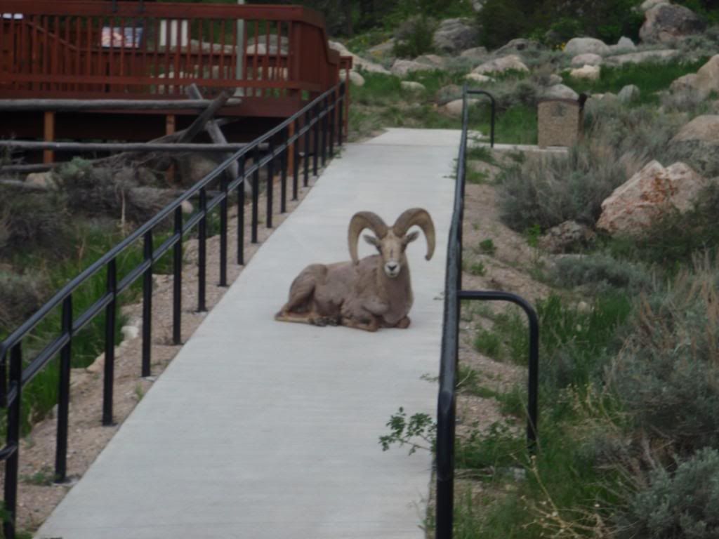
After getting into Lander, I called up some of my parents friends who invited us up to their house just out of town. Before dinner, we took a ride up to Sinks Canyon, where a river flows into this cave and then reappears about half a mile down the mountain. It was pretty interesting to see the river bubbling up out of the side of the hill. Also while we were there, a Big Horn Sheep made its way right up to the visitor center. Afterwards, we returned for an incredible dinner of antelope burgers, home grown asparagus, and homemade apple sauce. The best meal we've had on the trip by far.


Tomorrow we're going to try to get out of here early and make a long haul to Rawlins, WY. Hopefully the wind and weather will be with us, making the 124 miles doable. If not, we'll probably end up in Jeffery City for the night.

P.S. Apparently here you say, "ride with the wind" not "ride like the wind".

Saturday, May 30, 2009

Togwotee Pass

Day 23: 66 miles - Today we rolled out of Colter Bay and got a few last glimpses of the Tetons across the lake before heading up hill. Looking at the maps, I knew there was going to be a lot of climbing today - almost 3000 feet gain over 20-25 miles. As we started up, the grade was pretty moderate, allowing for a smooth, steady cadence. The first 10 miles of the climb passed pretty quickly and we stopped at the Togwotee Mountain Lodge to inhale a powerbar and take a breather. I didn't realize that we had already dealt with most of the elevation gain. From there, it was only slightly uphill for the next 5 miles and then a short 4 mile spike to the summit. After we crested the pass, Andy and I both commented on how much smoother it went than expected. The second highest elevation of the trip out of the way - no big deal.
On the climb, once we had gained a little elevation, we got a great view from behind of the Tetons and Jackson lake. Further up, we lost the view of Tetons behind us, but got to scope out the two peaks on either side of the pass. Also, we spotted a red fox part way up the climb. I think I was quick enough on the draw to get a picture, but I'll have to see later when I get them on a computer.
From the top, it was pretty much all down hill with a tailwind to Debois, WY. I don't think we really dropped below 25 mph for the 30 miles into Debois. Overall, the day was really pleasant and flew by much more quickly than I had anticipated.
Tomorrow we have a pretty gradual day to get to Lander, WY. Let just hope we don't have too much wind to fight. Wyoming is known as the windiest section of this trip.

Tetons

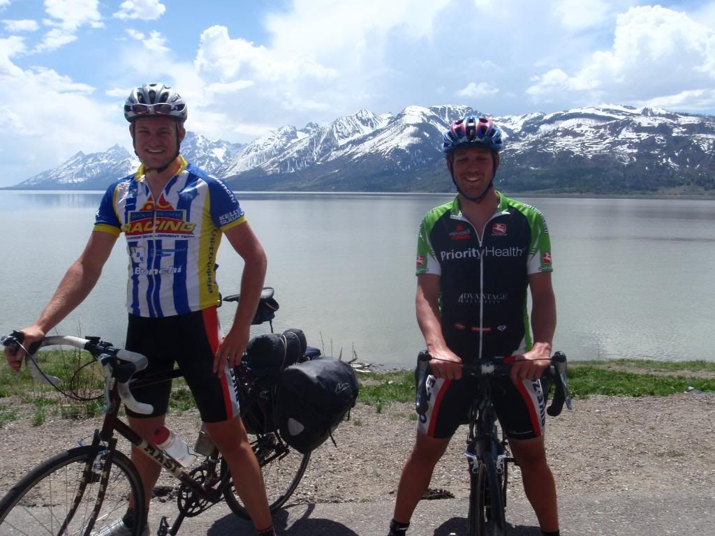
Day 22: 42 miles - Descending out of Yellowstone this morning, I saw probably the most snow all trip. In most places in the park, there was spotty snow but here, there was at least a 4 foot wall on each side of the road. We also rode by Lewis Lake which was still completely frozen over. It's weird to see both of these things when it's 65 degrees out wearing shorts and a jersey. After a ways further, we entered Tetons National Park and came up on Jackson Lake with our first view of the Tetons. The view of the mountains over the lake is probably my favorite thing so far. Being able to experience something that rugged is awe inspiring.


Tonight we're camping at Colter Bay just on the other side of the lake from the mountains. Tomorrow we'll be heading to Dubois, WY and hitting the second highest elevation for the entire trip over Togwotee Pass at around 9700 feet.

Yellowstone Lake

Day 21: 42 miles - Today we continued on our alternate route through the park at our super east rest day pace. We rolled out of Canyon Villiage early this morning and realized that we had missed a trail yesterday that led down into the canyon to the top of the falls. We figured we had all day so we took a hike, and it turned out to be really cool to see the canyon and falls from a lower vantage point. From there, we pedaled up the Yellowstone River to Yellowstone Lake. The view of the lake with the mountains was one of the most amazing views so far. Beyond that, we stopped at the West Thumb Geyser Basin where we saw more subthermal activity. At this location, there were actually geysers in the lake. Also, the geysers and springs here seemed much clearer and with a bunch of different tints and colors. We finished up the day in Grant Village in a campground that hasn't opened for the season yet.
At the campground, we ran into Nick again as well as another group of a guy and two girls from Wisconsin riding from Denver to Canada. Matt, Liz and Lacey were heading out tomorrow on the same route we took today to Canyon Village. Nick is actually going to bust out the last 80 miles to Jackson tomorrow to finish out his tour. Congrats on the completion.
Tomorrow we're heading out of Yellowstone and into Grand Tetons National Park to Colter Bay.

Yellowstone

Day 20: 41 miles - We had planned to take our time through Yellowstone to give the legs a little rest and so we'd get to see everything we wanted to. Our maps gave us a route through the park but didn't really give much on great places to stop. So for that, we stopped at the West Yellowstone bike shop Free Heel and Wheel for some advice on the way out of town. They convinced us that taking a route through Canyon Village and Yellowstone Lake would be more worthwhile than the route by Old Faithful that the TransAm map provided. So we headed into the park following the Madison and then the Gibbon rivers to Norris Geysers. Along the way we saw some great rivers along with some Bison and Elk. We stopped at Norris and took a little hike to check out all of the geysers. It's amazing that all that heat from so far down can be transferred to the surface. From there, we rolled on to Canyon Villiage. Once there, we took a hike down along the canyon to check out the falls. I really didn't know what to expect coming into it, but it was really amazing. The falls was over 300 feet tall and the canyon walls were over 1000 feet tall in some places. It was awesome to see the Yellowstone River flowing for miles through this deep canyon.


It turned out that the campground at Canyon Village was not open for the season so we rode around the village looking for a place to pitch a tent. We went down behind the lodge towards the area with the cabins thinking we might find some utilities. The cabins hadn't been opened for the season either, but they had been opened up to air out before guests arrived. So as we rode by, several of the cabin doors were wide open. We waited for it to get dark and then quietly pulled all of our stuff inside. Long story short, we got a free bed in a heated cabin courtesy of Yellowstone National Park. What a treat.

We also met a guy who started in New Hampshire in early April and is riding to Jackson, WY. He had planned to move there to work in a resort town and figured he'd just ride his bike there. He's only about 140 miles away, so he should be finishing up his 3000+ mile ride here in a few days.
Tomorrow we're planning on taking another short day, heading south to check out Yellowstone Lake.

Wednesday, May 27, 2009

Wind

Day 19: 72 miles - I started out this morning excited about the days ride partly because it would get us to the edge of Yellowstone and partly because I had a semi functional rear wheel. The profile showed a gradual gain of about 2000 feet over the first 55 miles so I figured it'd be a pretty fast day. We pulled out from our campsite on the Madison River and immediately had the wind in our face...and it stayed that way all day. After a slow, 4+ hour slog, we finally got to West Yellowstone, Montana.
Once here, my primary goal was to do something about my wheel. We rolled up to one of the bike shops and the owner agreed to help me. We left to unload and pitch the tent, then I went back to get to work. When I got back, the shop owner offered to let me use his tools and truing stand in the shop. So in a little less than an hour, I got the drive side of my wheel rebuilt with new spokes for only $18. It was super generous for him to give me free reign of the shop and a big relief to have a reliable wheel.
On the whole, I was a little disapointed with West Yellowstone. I knew it was a destination town, but I expected a little more character. There a lots of little retail shops but the feel honestly reminded me a little of Gatlinburg, TN.
Tomorrow we'll be heading into the park and into Wyoming. I'm not sure where we'll end up yet, but I'm excited about seeing the park and doing some exploring off the bike.

Taking chances...

Day 18: 72 miles - I got up this morning not knowing if we were going to ride today or not. I spent all morning calling everyone I knew asking for advice concerning this wheel dilema. The general advice was either "you're screwed in Dillon if you need bike work" or "you're only real option is try to get to west yellowstone". As a last ditch effort, we rode by the local bike repair shop that I had been trying to call all morning to find out that it was closed for memorial day. With no other decent options, we decided we'd head out and I'd be as gentle on the wheel as I could. I knew the big challenge for not doing further damage would be the 2000 foot climb about 55 miles in. We slogged through the first bit, fighting a headwind most of the way before coming up on the climb. I took it really easy up the climb, spinning as smoothly as possible, and topped out without any more spoke casualties. From there we had a nice panoramic 10 mile descent into Ennis. Coming down, we saw a bunch of pronghorned antelope and some whitetail deer, but I was too slow on the draw to get any pictures.
While we were getting settled, a group of three cyclists rolled into the area where we were camping. They had started in south Texas and were heading for Alaska. I started telling one of the guys about my wheel problem, and it turned out he had a cassette tool and a few spokes that were exactly the right length that he offered. So with his huge help, I got my two broken spokes replaced and should be able to make it West Yellowstone without any trouble.
So tomorrow, 71 miles to West Yellowstone and the end of Montana.

Sunday, May 24, 2009

Rain...

Day 17: 67 Miles - About an hour after I crawled into the tent last night, it started raining. I thought It'd pass over the night and not really be anything to worry about. Every time I woke up during the night, it was raining, and continued to rain all morning. We decided that it would be miserable to start our the day riding in the rain, so we bummed around Wisdom, MT until about 2pm. By then, the rain had let up and we rode on to the next town, Jackson, MT. We decided we'd take a chance on the next 45 miles, allowing us to get to Dillon, MT and fill our planned mileage for the day. We got over the first pass, the highest of the trip so far at over 7300 feet, with no problems and weather looking good. We cruised on to the second climb of the day and crested it with less than 20 miles to go. Looking good right? - wrong. With about 15 miles to go, the skies opened up and dumped everything its been holding back for th last two weeks. We thought we'd been able to sneek through the rain by delaying our start, but it found us in the end. I guess its better than having it rain all day or even starting in the rain.
Other than the rain, the day was great. Each climb was about 1000 feet with pretty good views off of either side. We also had a pretty good tail wind for most of the day which allowed us to finish with an average speed of 20.0 mph for the 67 miles, our best average for a day for the trip so far. We also had another best...our max speed for the day was 45.1 mph...try that with a fully loaded bike and a broken rear spoke.
Speaking of, while we're in Dillon, I've got to try to find some spokes to rebuild the drive side of my wheel. I've had a few spokes break here and there and have been able to get them fixed, but rebuilding it should solve these problems. So much for putting trust in a worn out wheel.
Tonight we treated ourselves to some shelter from the rain in a Super 8 in Dillon. Tomorrow we should be heading to Ennis, MT and then West Yellowstone on Tuesday.

Continental Divide

Day 16: 72 miles - We headed out from Hamilton on a pretty busy highway following the Bitterroot River south. This section of road was especially annoying with high speed limits and increased holiday weekend traffic. We stopped in Sula, MT for some lunch before the big climb of the day, and fortunately, by then, the traffic had thinned out considerably. From Sula, we gained another 2800 feet over 14 miles, clearing Lost Trail Pass at 7014 feet and then Chief Joseph Pass at 7241 feet. This climb wasn't really as bad as I had antcipated and the temps were warm, but we still got to see a lot of snow. For the 3600 foot gain, most of the grade was gradual. This was our highest point of the trip so far and our first crossing of the Continental Divide. From there we descended about 1000 feet and cruised 25 miles across a huge plain to Wisdom, MT.
Also today, we caught another rider heading for the east coast. He is doing a charity ride to raise money for a cause that helps children in Honduros. He said that he had been able to call up a bunch of hotels on his route and had a free place to stay pretty much every night. He also had his wife driving a van with all of his gear and a back up bike. Really not a bad deal at all.
Tomorrow we're planning on riding about 62 miles to Dillon, MT.

Friday, May 22, 2009

1000 Mile Mark

Day 15: 68 miles - todays highlights were pretty limited: breaking a spoke, hitting 1000 miles and about 15 miles of paved bike path. That's not to say it was a bad day, just pretty uneventful. Lots of cruising in the Bitterroot valley, several moose crossings, but no mooses and eventually a nice campsite on the Bitterroot River. Tomorrow is a climb to over 7200 feet and our first labeled crossing of the continental divide. Our plan is to stay in the town of Wisdom tomorrow night - hopefully a wise choice.

Pictures

Ok so I thought memory card readers were a pretty common thing before I got out here and was banking hard on libraries having them so I could upload pictures. Turns out that's not the case. So until I got the cord that mom is sending me or figure something else out, I'm afraid there won't be any pics. If anyone has an idea, leave a comment.

Lolo Pass

Day 14: 78 miles - So we picked up where we left off yesterday riding up the Lochsa River along part of the Lewis and Clark trail toward Lolo Pass. This stretch of road goes for over 66 miles with zero services offered at all, so we ended riding about 58 miles and gaining about 2000 feet before stopping for lunch. From there the grade got a little steeper for the remainder of the climb up Lolo Pass(elev. 5235 ft). We finally reached the pass at about mile 70, entering into Montana, and seeing a fair amount of snow for the second time of the trip. From the top, we coasted down the otherside to Lolo Hot Springs for the night.
Tomorrow we're planning for about 60 more miles in Montana which will put us over the 1000 mile mark since Astoria. Also, we should be getting close to Yellowstone in about 4 days.
Side note: for some reason none of the campsites we stayed in in Idaho had showers since the Idaho Power park in Hells Canyon on the Oregon state line. This means we made it through a whole state without showering. Don't worry though, we got a well needed one tonight in Lolo Hot Springs.

Clearwater River

Day 13: 88 miles - We started out with about a 7 mile warm up before hitting the climb up White Bird Hill. This climb makes use of 8.5 miles of switchbacks to gain 2500 feet up this completely grass "hill". Also, this hill is part of the Nez Perce National Historic Park containing Whitebird Battlefield. Once at the top, we coasted down to Grangeville for some lunch. Afterwards, we descended down to and along the South Fork of the Clearwater River through the Nez Perce Indian Reservation. Eventually we headed east up the middle fork, beginning our initial ascent of Lolo Pass and into Montana.
Our camping location was again primo. We ended up stopping at a U.S. Forest Service campground right on the Lochsa River and practically had the place to ourselves.
Tomorrow we gradually climb for the next 70 miles to Lolo Pass and Montana.

Salmon River

Day 12: 75 miles - So we got up and headed out from the little town park in Council were we had decided to camp. Again we were paralleling the Weiser River up to New Meadows were we stopped for a bite. From there headed down the Little Salmon River which was a beautiful raging mountain stream in this narrow gorge. We started out descending with a great tail wind and were making great time for the day. About 15 miles down the river, the wind decided to change directions on us so instead of averaging 25, we were now fighting to get 13. We continued down where the Little Salmon River become just the Salmon River and ended up at a great campsite right on the river.
This last week or so of warm weather has really jump started the melting in higher elevations so all of these rivers are much higher than their normal state. While camping on the Salmon, the water was really muddy and full trees could be seen floating down the river.
Tomorrow we spend a little more time following the river before doing some more climbing.

Monday, May 18, 2009

Hell's Canyon

Day 11: 62 miles:
So this morning we got up and moving in our favorite campsite so far. This campground was right on the Snake River and was owned by Idaho Power. The park was just really well kept and landcaped for such a rugged location. As we headed out, we rode for about 11 up a section of the Snake River known as Hells Canyon. The climate around the river is considered high desert while the area right on the banks has very lush vegetation. It was really cool to see this contrast with huge mountains shooting up on either side. Once we reached Brownlee dam, we started up a 7 mile, 2000 foot climb out of the gorge. This was one of the hardest climbs so far with the combination of the steeper grade and exposure to the sun. Once over, we coasted down to Cambridge for a bite to eat.
After lunch we decided to take an alternate route from Cambridge to Council along the Weiser River Trail (www.weiserrivertrail.org). This was an old gravel railroad bed that is now a huge recreational outlet for the area. It turned out to be a little rougher than anticipated but was still a good alternative to the busier highway.
Tonight we are camping on Council ID and plan on getting to Slate Creek Campground on the Salmon River tomorrow night.

Sunday, May 17, 2009

Hot

So we woke up sweating in the tent this morning knowing it was going to be a hot one. We rode the 40 miles to Richland where we got some lunch without the heat being too much of a factor. After lunch we started up the 6 mile climb between us and the town of Halfway. I really wasn't expecting much but the decent grade combined with the recent lunch and the 97 degree blazing, completely exposed heat took it's toll. We got to the top and coasted down to Halfway where we grabbed a cold drink and waited for some of the intense midday heat to pass. Eventually we finished out the day to Oxbow for a total of 69 miles for the day.
Tomorrow brings a new state and a new time zone with a hopeful destination of Council ID.

Saturday, May 16, 2009

Ore-gone

Picking up where I left off in Corvalis, we finished up day 4 with good weather in Coburg for a total of about 64 miles.

Day 5: We had just gotten completely packed up and were heading out of the nothing special campground in Coburg when some dark clouds rolled on and it started to rain. We ended up riding the 16 miles to Walterville in the cold rain where we stopped to grab a bite to eat. Luckly we left Walterville with a break in the storm and were able to get about 20 miles in before the next wave hit us. Long story short, we were soaked and cold when we got to McKinzie Bridge so we opted for some civilized lodging to get everyting dried out. All told - 58 miles

Day 6: The main route for this leg takes a scenic route over McKinzie pass between Mt. Washington and the three sisters wilderness. Unfortunately for us, this route is still blocked by snow so we were forced to take the alternate route over Santiam Pass. Santiam pass topped out at 4817 ft...about 500 ft shorter than McKinzie pass but added an additional 13 miles. We finished up the day in Sisters Or where we stayed on a ranch owned by Jim and Patty Evered. This awesome family has opened up their land and their showers for cyclists on the TransAm for years and it was really great to hear some of their stories. Day 6 - 58 miles

Day 7: We woke up that morning to feeling like the tent was going to fly away with us in it. Right away I knew it was going to either be a really fast fun day or a really frustrating slow day. We packed up and headed out fortunately with the wind to our backs. We blistered through the first 40 miles averaging over 20 mph (seriously, fully loaded). After our lunch stop, we started the 2000 ft climb up Ochoco Pass. The pass topped out at about 4700 ft and we descended back down the other side into Mitchell, OR. Our final average for the day was 18.8 mph for 88 miles...probably one of the fastest and easiest 88 miles I've ever ridden.
Also in Mitchell, we ran into two other guys also riding the TransAm. One guy, Zac, was from Los Angeles and the other, Matt, was from Las Vegas. Both of them were completely new to touring or cycling for that matter and were pulling "bob" trailers packed to the max. I couldn't believe how much the were hauling when they rode up. They said that they had to weigh their gear to get on a train and they were each carrying 70 pounds in the trailers. I'll pass on that.

Day 8: We headed out from Mitchell straight into a 7 mile climb. This rough start to the day was followed by rough rural roads and some headwind. Even though I wasn't feeling great on the bike, we had some really beautiful scenery. We rode through the John Day Fossil Beds National Monument and down a section of highway 26 called "Picture Gorge". Day 8 was a good but difficult 84 miles ending in Prairie City, OR.

Day 9: Today gave what I was craving: more mountains, less prairie. We had three good climbs today, each being about 1500 ft gain. These climbs were a little more like what we are accustomed to back home...a little shorter and steeper than the climbs of the past few days. Each of these was about 7 miles long as opposed to the 20 and 30 mile climbs we've been seeing. After the last climb, we finished out the day following the Powder river into Baker City, OR.

Upon arriving in Baker City, we finish up the second map and break the 600 mile mark. Tomorrow we head for Oxbow, right on the Idaho border.

Pictures hopefully to come later

Monday, May 11, 2009

Corvallis

So today we grabbed some lunch in Corvallis and stopped off at a public library to check some email and update. Here's what's happened so far.

Day 1: Astoria to Manzanita: We spent about 47 miles riding along the Oregon coast and stopped at the best campground so far. Weather was sunny with temps in the 50's. We got a ton of ocean views and stopped a few times to take it in. At the campsite, we met a few other people doing some touring. One older guy was by himself riding all the way down the coast to San Diego. He said he'd been touring since the '70s and has never really gotten tired of it. Another German couple were riding up the coast from San Diego to above the Canadian border. Once they finish their, they plan on flying to the east coast and riding down the Atlantic Canadian Coastline to New York.


Day 2: Manzanita to Cape Kiwanda: Saturday was about 68 more miles of riding along the coastline down HWY 101. Again we got a bunch of great views and got a pretty good campsite right across from the beach. We met a few guys camping there who were there for the weekend to do some surfing.


Day 3: Cape Kiwanda to Rickreall: Sunday was another 69 miles and probably the least exciting day so far. We had one good 10 mile stretch of backroads to start out the day followed by a good lunch at Otis Cafe before about 50 miles of busy, not neccessarily special roads. We ended up in Rickreall and camped under a covered porch of the Polk County Museum.

For the remainder of the afternoon, we'll be heading to Coburg, OR and will be finishing up our first map there. Pretty much as soon as we head out from Coburg, We'll be hitting the mountains with 4,000 ft elevation, 25 mile climb to the top of McKinzie Pass to get us over the Cascade range.

Friday, May 8, 2009

We made it

Highlights from the trip:
- 4 am wake up
- finally got to Portland at about 11:00 am pacific time
- We recieved two free metro train tickets to go into portland to grab some lunch and walk around for a bit
- Went back to the airport and eventually left for Astoria as the only two passengers on a sea port air nine passenger single turboprop plane. During the final approach into Astoria, we saw a big bald eagle right out the front window.
- We get to astoria and walk around the waterfront for a while and then up the hill to the Astoria column. www.astoriacolumn.org
- Today we're picking up bikes and hitting the road down the coast.

Thursday, April 23, 2009

2 Weeks...

So we shipped out this bikes this morning via fedex to a bike shop in Astoria. Hopefully they'll arrive unscathed and be waiting for us when we get there 2 weeks from today. Alright, nothing left but a week of exams and a week of "am I really sure I want to do this".

Saturday, March 28, 2009

SB '09

So Andy and decided that spring break would be a great opportunity to do some touring and work out some of the kinks ahead of time before we kick it into high gear this summer. I also realized that once I got to the beach, all bets on physical exertion were off. That being said, Andy and I headed out discarding all advice from Jeremy (aka rainman) shaking his rain sticks, weather.com and against our better judgment about 1:30 on Friday.

Our goal for the first day was to get to the Tsali/Fontana area. We headed out via the normal South Knoxville route to Walland. From there, we climbed up and over Foothills Parkway to HWY 129. It turned out that riding the "tail of the dragon" on a overcast Friday afternoon was probably one of the best times to do it and we were blessed to see literally no traffic. On a side note, tail of the dragon does not seem to have that much elevation change when driving it, but riding it while still getting used to riding a loaded bike was a challenge. Once over HWY 129, we rode HWY 28 to Fontana Villiage. All told, Friday ended up being a pretty challenging 75 miles.


We managed to get through Friday without seeing any precipitation at all, but knew it was coming that night. With that in mind, we decided to stop a little early, hoping to have a dry night, and rode up to one of the back cabins at Fontana Villiage. We used a tarp and to close in the front of one of the covered porches and had a perfectly dry night. Definitely a good decision to be able to start dry on Saturday.


Saturday we woke up to rain, and with without any sign of it breaking, got packed up and headed out. We stayed on HWY 28 for a pretty hilly yet uneventful while until we rolled into Franklin, NC. In Franklin, we grabbed some lunch and I had to fix a flat due to a cheapo rimstrip in my rear wheel. Luckly, right as I flatted, we rolled up on Smokey Mountain Bikes where they let me use a stand and floor pump out of the rain. It really made me appreciate the small things. Anyway, we headed out from there continuing on HWY 28, making the 9 mile climb up to Highlands, NC. From there, we hauled downhill through the tip of Georgia and into South Carolina, finishing the day in Clemson, SC. Looking back, Saturday was by far the hardest day, totalling about 115 miles and the most difficult terrain of the trip. Saturday night, we were able to stay with one of my friends from BMW in Clemson. It was really nice to get a comfortable place to sleep and dry some clothes.


Saturday was more of the same...rainy, cold but flatter. We left Clemson and arrived at my grandparents house just outside of Columbia, SC about 120 miles later.

We knew Sunday was going to be a long day, but when we mapped it out Saturday night, it ended up being about 155 miles to Isle of Palms, SC. We headed out early and rode at a pretty good pace all day. When we got to Monks Corner, we realized that we were running out of daylight. We really dropped the hammer and rode like crazy, racing the sun for the next hour or so. We ended up getting to the connector onto the island a little after 8PM and decided that it wasn't worth trying to ride the very busy bridge in the dark. In this case, getting a ride for the last 4 miles was probably the wisest decision. Fortunately for us, the friends we were meeting down there came out and gave us a lift onto the island. Monday was a very long day in the rain and ended with a little more frustration than I had expected. Looking back, I was still pretty satisfied with our 150 mile day in the pouring rain.

Any doubt I had about the big things turned out to not be a big issue. My panniers kept everything dry, they were big enough, bike was comfortable (relatively), fit was good, and legs felt good all the way through. We really just have a few fine tuning things to take care of, and I think we'll be set. After riding in terrible conditions and covering some serious mileage, I'm gaining confidence and anticipation for our trip this summer.

Things learned from this experience: riding in the rain sucks, there is not a flat spot between here and Clemson, SC., a pump that goes over 70 psi would be nice, subway bags are awesome as over-socks, and road on maps do not neccessarily have to exist in real life.

Until our next regretable experience...

Wednesday, January 28, 2009

Coming together...

Within the last couple of weeks, Andy and I have tied up a lot of loose ends for our trip this summer. With the most recent plans, I'd say we are committed at this point. In the first couple of weeks this semester, Andy ordered the route maps from Adventurecycling.com for the TransAmerica Trail. Here's a little sneak peak at what the route entails.


Along the same lines, Andy and I have both picked up our bikes for the trip. Andy found a good deal on an '08 Specialized Tricross Comp and I found a Masi Speciale CX. Check them out below.


Also, last week we took the final plunge and booked flights to Oregon. We are booked to fly from Chattanooga to Portland Or. on May 7th, just two days after exams. Now we just have to figure out how we are getting from Portland to Astoria. More to come later...